About AmazoniaForever360+
AmazoniaForever360+ is a free tool initiated by the IDB as part of its Amazonia Forever program to help all those involved in the development and conservation of the Amazon to better understand this immense and complex territory. Starting from this first beta version, we will continue to develop this platform in collaboration with key actors in the region and beyond. Stay tuned.
Key Features
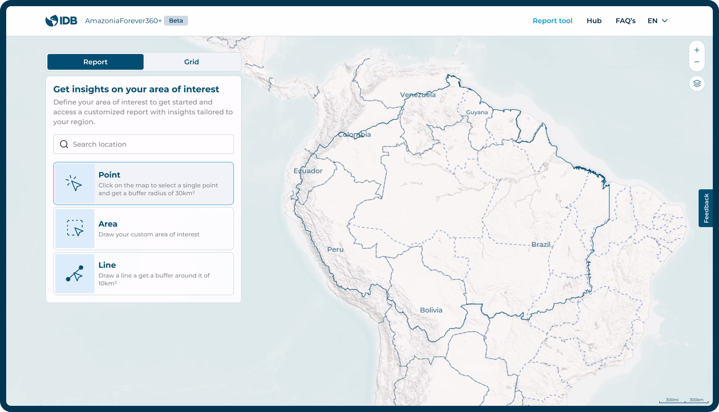
Generate Reports in Minutes
Create customized reports focused on your areas of interest, with actionable insights and data visualizations generated instantly from our comprehensive territorial knowledge base.
Select area of interest
Define topics of interest
Share and download


Key Features
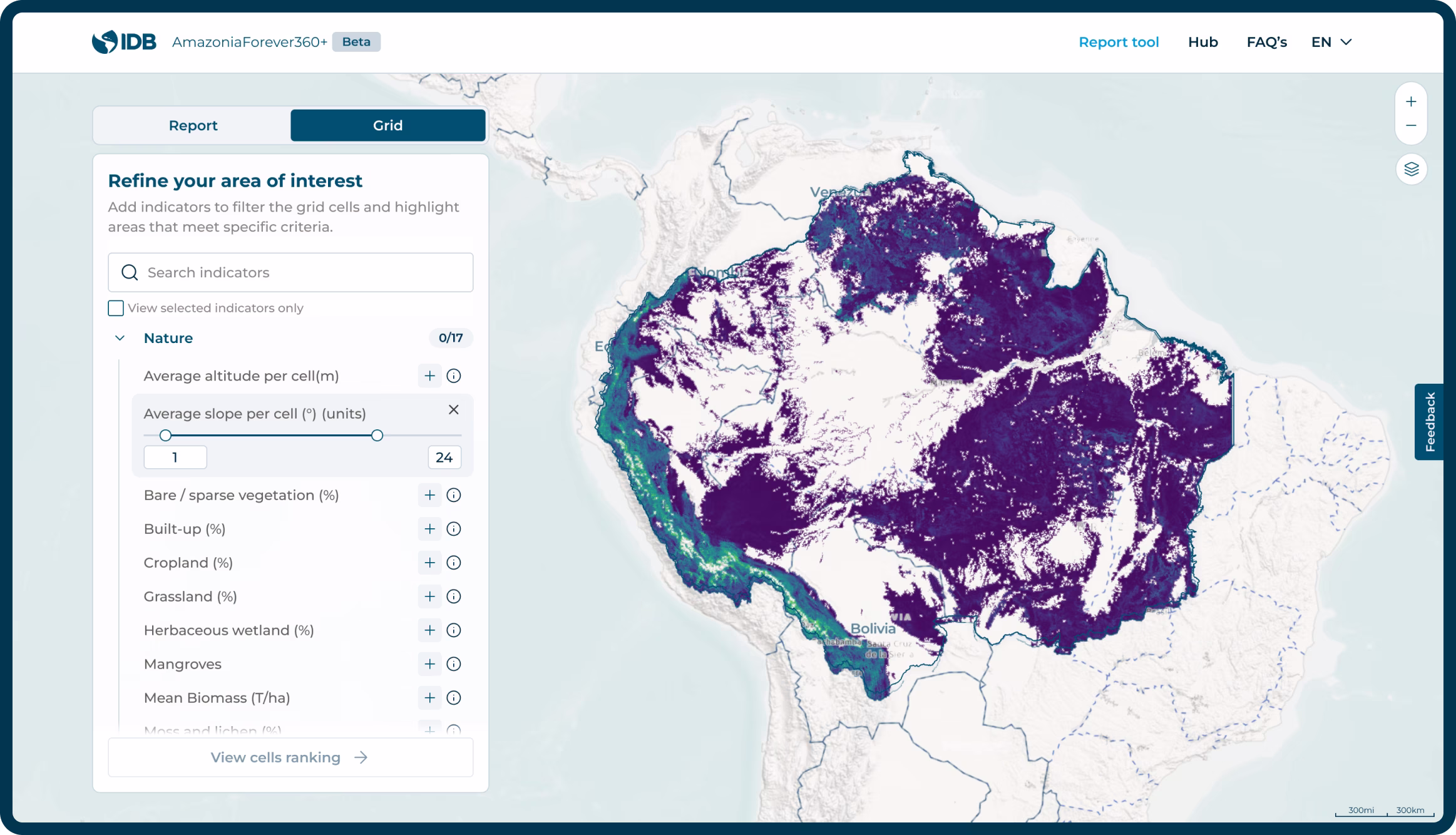
The power of Amazonia Grid
Grid-Powered Analytics Beyond the report, dive deeper into your selected area using our standardized hexagonal grid system to play with indicators and identify locations that match your specific criteria, from biodiversity hotspots to demographic patterns.
Identify hotspots
Identify hotspots
Create report
information on
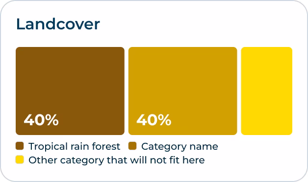
More than 60 indicators
from different topics
Navigate through a curated selection of topics to uncover the Amazonia's multifaceted story. From environmental to socioeconomic dynamics, our platform brings you a comprehensive perspective.
Amazonia at a glance
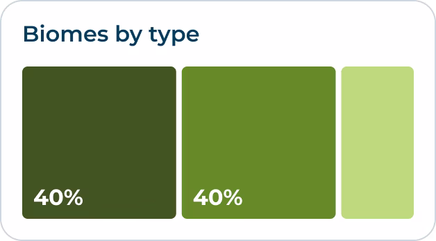
A mosaic of ecosystems and habitats
A Continent-sized Mosaic of Cultures and Nature Across Eight Countries Spanning 8.4 million square kilometers across eight South American countries, Amazonia represents one of the planet's most diverse confluences of cultures and ecosystems.
Select indicator
Source:
- Global Human Settlement Layer (GHSL) - Population projection for 2025;
- Cartographic area
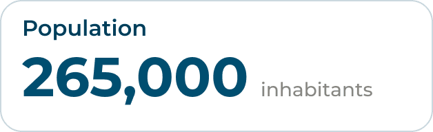
Country Amazonia Population (%)
Percentage of a country's population residing in its Amazonia Forever work area